
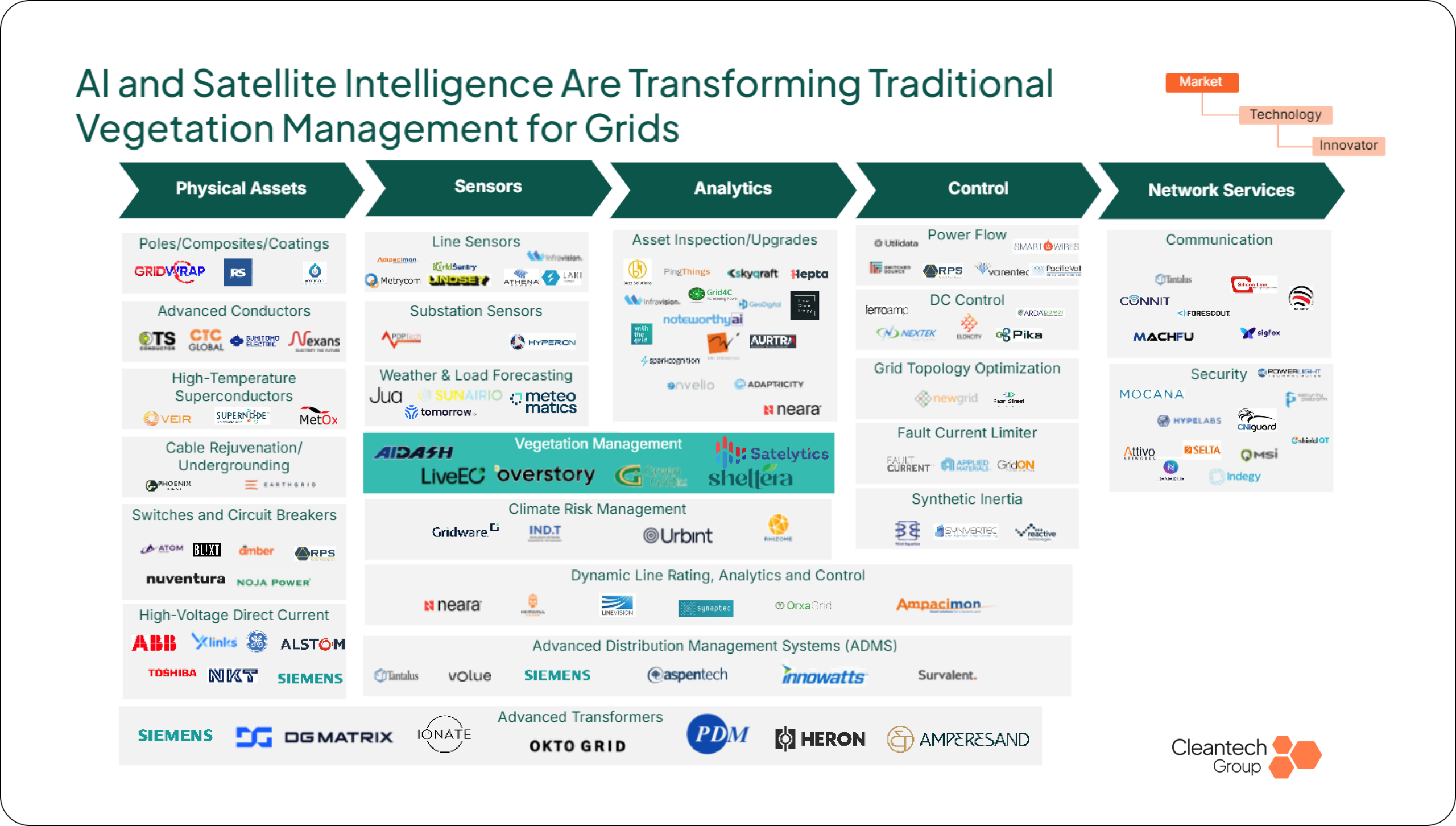
Utility vegetation management has run for decades on a slow detect-and-react cycle: calendar-based trim schedules, visual foot patrols, and expensive, weather-dependent light detection and ranging (LiDAR) flights. That model assumes trees grow and die at predictable rates. Extreme and erratic weather is breaking that assumption, and it is the main reason utilities are moving from periodic inspection toward continuous monitoring based on artificial intelligence (AI).
In July 2026, Schneider Electric paid $350M for a majority stake in AiDash, giving the category its first real valuation anchor. The buyer matters as much as the price. Schneider is a 180-year-old industrial and energy management company with a global grid and building automation business, and its move places vegetation intelligence inside the core grid software stack, well beyond the compliance checkbox utilities have long treated it as.
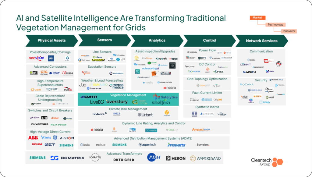
Source: Cleantech Group
Prioritization Is the Product
Detection is fast becoming a commodity. The innovation that matters is prioritization: turning a constrained utility budget into a ranked list of which trees matter, combining imagery with outage history, asset age, conductor specs, and weather data. Rather than more data, utilities need a defensible answer to where the next dollar of trimming should go.
Satellite-based platforms add a capability that LiDAR cannot. Multispectral bands detect crown dieback and declining tree vigor, while a LiDAR point cloud renders a dying tree identical to a healthy one. That shifts the work from trimming what is already too close to the line to removing what is going to fail, often years before it registers as a clearance risk. Satellite coverage also reaches beyond the right-of-way corridor that LiDAR flights typically follow, catching fall-in hazards from trees outside the maintenance zone.
The outcomes are starting to show up in reliability metrics. Hydro Ottawa recorded a 44% reduction in tree-related outages in its first year using Overstory, and another Ontario utility reported a 48% reduction alongside far fewer unnecessary truck rolls. LiDAR still holds the edge on centimeter-level clearance measurement, but for ignition and outage risk, health and reach are the more decision-relevant variables.
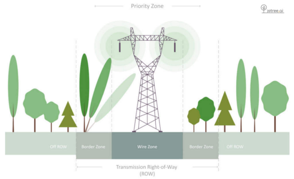
Source: Overstory
Workflow Is Where the Market Will Be Won
A detection feed alone no longer wins contracts. Several innovators now sell full-lifecycle platforms that run from risk detection through contractor coordination to audit-ready reporting. LiveEO’s Treeline converts flagged risks directly into scheduled work orders, Overstory Scenarios lets utilities model and compare mitigation strategies as a digital twin, and Sheltera’s mobile app lets field crews navigate to a site, bid the job, and document completed work in one tool.
The most valuable feature in this shift is verification. A platform that lets a utility confirm trimming was done correctly from imagery, without sending a crew back out, becomes part of how the utility proves its work. That is far harder to rip out than a standalone risk score and is also a significant part of what Schneider paid for: the layer that turns a satellite pixel into a crew dispatch already wired into a customer’s existing systems, such as Esri ArcGIS or IBM Maximo.
Our view is that this segment is approaching a winner-takes-most dynamic, where workflow integration depth will matter more than feature differentiation. Fuel and wildfire-risk detection illustrates why. AiDash’s Climate Risk Intelligence System, LiveEO’s Wildfire Defense suite, and Overstory’s Fuel Detection Model all launched within roughly the same window, and fuel analysis is already table stakes. Beyond the classic evaluation axes of resolution, scale, and cost per mile, persistence is emerging as a fourth: wildfire fuel conditions change in days, favoring daily or continuous monitoring over periodic surveys.
Consolidation in vegetation detection is also creating room for a complementary layer above it. Buzz Solutions sits between a utility’s GIS and work management systems, taking risk outputs from platforms such as Overstory and AiDash and pairing them with drone, helicopter, and camera inspection data to rank asset-level maintenance actions. In one deployment, it narrowed 12,000 scanned poles to 112 critical wildfire-risk defects. That positioning suggests the stack is splitting in two: satellite platforms compete to own the right-of-way risk map, while tools like Buzz compete to own the decision of what gets fixed first.
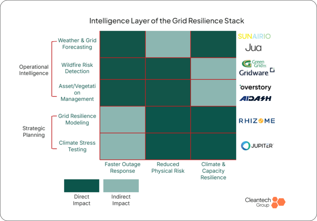
Source: Cleantech Group
Two Bets on Data
Vertical integration is splitting the field. Most innovators are asset-light, buying commercial imagery and avoiding hardware CAPEX entirely: Overstory sources from Planet Labs and UP42, Satelytics from Airbus and Maxar, and AiDash blends satellite with drone feeds. LiveEO is taking the opposite path with Twinspector, its own constellation designed to deliver 35 cm stereo imagery, with two satellites targeted for launch by 2028.
The commercial imagery market is already crowded and capital-intensive, so the marginal cost of buying data is falling faster than the payoff from owning it. At this stage of the market, we see vertical integration as the more expensive and riskier bet, and the asset-light model as the one that rides falling satellite costs without carrying launch risk.
Satellite is also not the only intelligence layer utilities are buying. Asset-mounted systems such as Green Grid’s camera and sensor units watch the structure itself for arcing, wire slap, and pole lean, hazards that periodic imagery misses by design, and some integrate with supervisory control and data acquisition (SCADA) systems to support protective action before ignition.
What to Watch
Regulators are raising the bar on spending. Michigan has ordered shorter trim cycles and Texas is reportedly beginning to monitor what utilities spend, which favors vendors that can quantify outcomes per dollar. At the same time, wildfire liability is pulling vegetation management out of the operations and maintenance (O&M) line and into enterprise risk conversations that boards and insurers now expect utilities to answer directly.
The next 12 to 18 months of AiDash’s integration inside Schneider will set the tone for exits across vegetation management and grid resilience. The deal works as a valuation floor, but that floor cuts both ways: an announced acquisition and a successfully integrated one are different events, and the next transaction in this category will be judged against whether AiDash delivers inside Schneider, not only against the headline price.
Join Our Community
Stay informed of our latest market insights with our newsletters and receive invitations to a regular stream of events and webinars, online and in-person.